Map of every place in Old Testament Israel
Purchase this high resolution vector file and print it at any size without losing resolution
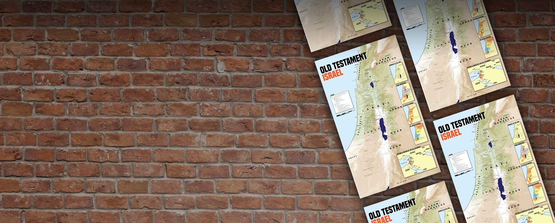
Searching for large, detailed wall maps illustrating the Israel of the Old Testament?

Overview
Our map of Old Testament Israel is the largest and most detailed map of Biblical Israel available online.
No other map on the market contains every single village, town and city mentioned in the Old Testament along with geographical places and landmarks and whole lot of other information. Designed to be printed as a wall poster 80cm by 130cm (2.6 x 4.5 ft), this map is provided as a vector file, meaning that it can be printed at any size without losing definition.
Currently this map is available as a digital download with two options: you can purchase the map as a PDF file for printing, or you can get the original vector and use the file for your own projects.
The map contains 23 separate layers that can be hidden or made visible in your PDF viewer allowing you to customise your poster further by removing information you do not want.

Map Layers
Every village, town and city in the Old Testament (Cities mentioned only in the district lists of Joshua included on a separate layer)
Original forest cover in ancient Israel (plus Cedar forests of Lebanon)
Roads and Highways
The two major climactic regions (deserts and wilderness v fertile regions)
Locations of the 12 Tribes of Israel, surrounding nations plus the locations of minor tribes and remnant peoples
Location of Levitical cities and cities of Refuge
Contour lines indicating major topographical features such as significant mountains and valleys
Lakes and rivers
Some (limited) archaeological sites not mentioned in the Bible
Locations of the Judges
Optional layer showing borders of Israel and surrounding nations during the time of the monarchy.
Map variations available
(included as layers within the same map file)

The standard version excludes some of the towns and cities mentioned only in the district lists of Joshua for clarity.

This version includes the towns and villages mentioned only in the district lists of Joshua.

This version shows the borders of Israel and it's neighbours during the period of the monarchy

A simplified version designed for younger audiences or viewing at a distance